Cumbria Way
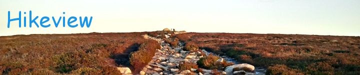
This is the Cumbria Way Page. It features an interactive map that is intended to help anyone planning a hike along the trail to plan the each days walking. To this end the path is clearly marked with alternating red and orange sections. Each section is 2 miles long except the last section into Carlisle which is 2.5 miles long. Here are some photos of the type of scenery available on the walk by RamblingPete (link in the links section below).
Planning a walk on the Cumbria Way The Cumbria Way starts in Ulverston and heads Northwards though the Lake District to finish in Carlisle. This is just the defined direction though and it is perfectly fine to walk Southwards from Carlisle to Ulverston. The Hadrian’s Wall Path also passes through Carlisle and so there is an option to link the two walks into one for a longer jaunt. Both Ulverston and Carlisle are on the rail network so getting to and from the end-points of the walk is quite straightforward.
Standard Sections The trail is typically divided into the following sections, each section representing a day’s walking. There is obviously no obligation to stick to this breakdown, and with this in mind the map below indicates the trail in two mile sections (alternating red and orange lines, though the last section into Carlisle is 2.5 miles). This allows you to quickly choose a day’s walking by counting sections up to the distance you feel comfortable with. This will depend on the type of terrain, so the terrain associated with each of the standard sections is described.
Ulverston to Coniston This section covers a distance of 15.75 miles. It starts out in Ulverston (33m) and quickly moves from the village into the fields where it remains for the day apart from some relatively brief excursions onto roads and lane-ways. Initially the first mile and a half climbs 170m at Higher Lath Farm. Then a quick descent to about 120m where it remains, moving up and down slightly until Keldray, where it climbs slightly again to Gawthwaite (170m) after which it drops again rapidy to 80m at Raisethwaite Lane. From here it climbs over predominantly moorland to Beacon Tarn (190m) some 3.75 mile on. A descent over 2.5 miles to the edge of Coniston Water (60m) followed by a roughly 3 mile lakeside walk with little variation in height into Coniston (60m) itself. Cumulative climb heading North: 630m. Cumulative climb heading South: 600m. Naismith’s rule estimates this at 6 hours 18 mins walking time heading North, and 6 hours 15 minutes heading South.
Coniston to Great Langdale (Old Dungeon Ghyll Hotel) This section covers a distance of 11.5 miles. From Coniston centre (60m) the trail heads West along the B5285 for a short time and the turns left into a laneway before a right turn onto a foot path. This heads steeply uphill, passing through a small woodland (129m) before descending again to pass near a farm (80m) and head into a more substantial woodland, where a good climb starts, first to 180m where it joins a road for a time before re-entering woodland on the East bank of the Tarns in Tarn Hows Wood, peaking at 230m. From here it descends to the A593 (160m), which it runs beside for a short time and then on through more fields and woodland to Elterwater Park B&B(90m). Coming down to the Great Langdale Beck the path follows this along fairly flat terrain to Elterwater (71m) where it crosses and then continues on lanes and paths to Oak Howe (88m) where the trail goes back to fields to New Dungeon Ghyll (90m) and then over moorland to Old Dungeion Ghyll (132m). Cumulative climb heading North: 500m. Cumulative climb heading South: 440m. Naismith’s rule estimates this at 4 hours 40 mins walking time heading North, and 4 hours 36 minutes heading South.
Great Langdale to Keswick This section covers a distance of 15.5 miles. It is mainly mountain walking but at one level but with a big hump over Stake Pass (480m) near the start. The initial trail from Old Dungeon Ghyll is through sheep-land and is mainly flat for a couple of miles. Then begins a steep climb up to Stake Pass (480m) and steeply back down to Langstraith Beck (277m) followed by a more gentle descent to Rosthwaite (98m). The trail then remains fairly flat over fields and moorland to Derwent Water by Manesty Park woodland. Here the trail skirts the East side of the lake, heading North to the Hawes End Landing, where it heads away from the lake a bit, into Fawe Park woodland. It emerges from here to head first into Portinscale and then on to Keswick (79m). Cumulative climb heading North: 640m. Cumulative climb heading South: 690m Naismith’s rule estimates this at 6 hours 14 mins walking time heading North, and 6 hours 19 minutes heading South
Keswick to Caldbeck This section covers a distance of 15 miles. Again it is mainly mountain hiking, in two humps, the first long (7.5 miles) and lowish (462m), the other shorter (4.5 miles) and higher (646m). From Keswick the trail initially heads along Brundholme Road, then turning onto Spoony Green Lane where it passes through fields, over the A66 and into the hills. This section climbs gently and peaks at Skiddaw House a bit beyond the 5 mile mark from Keswick. Then the trail descends equally gently for 3.5 miles to Carrock Mine and Grainsgill Beck (300m). Now a sharp turn to the left along Grainsgill Beck begins the ascent of High Pike (647m) over 2.5 miles. From High Pike the trail quickly descends to farmland and on to Caldbeck (164m). Cumulative climb heading North: 850m. Cumulative climb heading South: 770m Naismith’s rule estimates this at 6 hours 25 mins walking time heading North, and 6 hours 17 minutes heading South
Caldback to Carlisle This section covers a distance of 15 miles. This is mainly through farmland, meeting some woodland sections along the way, following the river Caldew for the majority of the time. This is essentially a long slow descent from Caldbeck (164m) to Carlisle (30m). Initially there is a small climb from Caldbeck through some woodland, after which it passes briefly through fields to more woodland West of the Caldew bank. At Sebergham it crosses the Caldew to the East side, passes through several fields, and then back to the West side. It now sticks right to the West bank of the Caldew for about 3 miles before heading away from the river over several fields to Buckabank where it crosses to the East again for a short time and then back west before coming to Dalston. Now it sticks close to the West bank again (apart from a short stretch along the railway line) all the way into Carlisle where it finally crosses back to the East side of the Caldew on a cycle path over a former railway bridge, ending up in Market Cross in Carlisle. Cumulative climb heading North: 180m. Cumulative climb heading South: 310m Naismith’s rule estimates this at 5 hours 18 mins walking time heading North, and 5 hours 31 minutes heading South
Accomodation Having decided how far you want to walk on a given day (taking into account the terrain descriptions given above) the next thing to do is arrange accomodation. Except where the trail passed through or close by villages and towns it is inevitable that you will have to deviate a fair bit from the trail to find a bed for the night. The best bet is to choose somewhere near your stopping point for the day, check for a suitable B&B in or around the village and when booking ask about transport options to and from the trail.
Bags While the trail is not too hard going it is far more pleasant to leave the heavy lifting to someone else, and a couple of services exist to help in this regard. The going rate seems to be 5 per bag per day. All you need do is provide them with your accomodation itinerary and they will see to it that your bags get picked up in the morning and are waiting for you when you stumble tired into your night’s accomodation. Link is provided below.
❮ ❯